Southland, Walks & Parks
-

Andersons Park - Invercargill
Anderson Park surrounds the Anderson Park Art Gallery and covers 24 hectares of flower and rose gardens, immaculate lawn, tall trees and native bush. There is also a traditional carved Maori house, a short bush walk circuit, duck pond and childrens playground. The Andersons' elegant home now houses the Anderson Park Art Gallery Society's splendid collection of quality New Zealand art. Situated on McIvor Road, Invercargill.
read more- Location: Invercargill - Andersons Park, McIvor Road
-

Sandy Point Domain - Invercargill
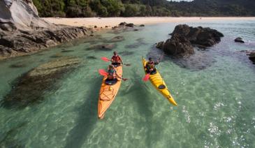
Located 7km west of Invercargill, drive to Oreti Beach on Dunns Road. The domain entrance is just after the Oreti River bridge and consists of over 2000 hectares of dunes, beach and bush. Also of interest is the ancient sand dune forest of wind sculptured Totara and Matai. The domain features several toilets and picnic/BBQ areas, and there are two playgrounds located in the Sandy Point Domain. Sandy Point is popular for various local activities or clubs: horsetrekking, kayaking, motor sports, mountain biking, paintball, rugby, rodeo, shooting sports, surf life saving and water skiing. There are also around 14km of walking tracks, making it easy to explore Sandy Point on foot. Example walks: Hatches Hill Lookout (5 minutes, one way) The track is signed at the turn off to Noki Kaik Beach. The lookout provides panoramic views across the New River Estuary to Invercargill and south to Bluff and Stewart Island. The track continues to the picnic area at Noki Kaik (15 minutes one way). Daffodil Bay to Hatches Hill (45 minutes one way) the track entrance is signed from the picnic area. It combines good estuary views with the unusual Totara-Matai forest so characteristic of this area. McShanes Track (25 minutes return) starts opposite the settlement of Cooper’s Creek and passes through an attractive remnant of native forest. At the Loop Road, cross the traffic barrier and turn left to return to Coopers Creek.
read more- Location: Invercargill, Sandy Point, 7km west of Invercargill, nr Oreti Beach
-

Otepuni Gardens - Invercargill
Winding pathways along the banks of the Otepuni Stream, located between Forth and Tyne Streets, provide a refreshing break from the city’s central business district. A few minutes’ walk from the city centre, Otepuni Gardens covers 9.4 hectares and encompasses four city blocks. The gardens were once the main city park, complete with a nursery, display houses and aviaries, but those have now gone, although the charm and beauty of the gardens still remain.
read more- Location: Invercargill - between Forth and Tyne Streets
-

Estuary Walkway - Invercargill
Walking/cycling loop track through the estuary margins (access off Stead Street). Well-formed gravel track (approx 5.5km) with boardwalks, providing views of the estuary. Interpretive panels, seating and shelters are along the track.
read more- Location: Invercargill, Stead Street
-

Greenpoint Domain - Bluff
Approximately 5 minutes drive from Bluff. Walking time approx 15 minutes one way. Access is signed left off SH1 immediately before Greenpoint cemetery. A peaceful setting for a shoreline walk and picnic with Bluff Harbour views. Suitable for buggies. At low tide it’s possible to walk along the beach. Interpretation panels explain the natural and historic features of this part of Bluff Harbour. At Greenpoint picnic area a viewing platform overlooks the ships’ graveyard and identifies some of Bluff Harbour’s historic landmarks. Visitors should be aware that the nearest public toilets are at Bluff. Note: The railway track is in regular use. Stop, look and listen before crossing.
read more- Location: Bluff, Greenpoint Domain, off SH1, nr Greenpoint Cemetary
-

Horseshoe Point - Stewart Island
From the general store, continue to your left, uphill on the Horseshoe Bay Road until you reach Horseshoe Bay (approximately 40 minutes). Turn right and follow the coastal track to Horseshoe Point (30 minutes). It is a great spot to view the comings and goings across Foveaux Strait. The track beyond Horseshoe Point towards Bragg Bay is not maintained.
read more- Location: Stewart Island, from Horseshoe Bay Road
-

Queens Park - Invercargill
80 hectares (200 acres) of gardens and parkland, minutes from the city centre and next to the main tourist information centre and Southland museum. Queens Park also has an impressive bird aviary, animal enclosures, children’s play areas, extensive sporting facilities, 18 hole golf course, observatory and cafes. Also prominent on the ground is the Southland Museum and Art Gallery. There is a 4 km fitness trail for the energetic, otherwise there are numerous paths and tracks throughout the park.
read more- Location: Invercargill - Queens Park, Gala Street
-

Bathing Beach - Stewart Island
From the general store, continue uphill to your left on the Horseshoe Bay Road and branch right when you reach Kamahi Road (after about 5 minutes). The signposted track descends on the left to a popular bathing beach.
read more- Location: Stewart Island, Horseshoe Bay Road
-

Observation Rock - Stewart Island
From the DOC Visitor Centre turn right towards the waterfront, continue right until you reach Excelsior Road on your right. Excelsior Road is an uphill climb, watch for the Observation Rock track sign on your right at the summit of the hill, a short forest track leads you to the rock forming the lookout, with great views over Paterson Inlet, particularly at sunset. To return to Halfmoon Bay retrace steps to the road and continue right, down the hill towards Golden Bay Road. A right hand turn will bring you back to town past Traill Park. Look out for Tui, with the distinctive white feather, or ruff, below its beak.
read more- Location: Stewart Island, off Excelsior Road
-

Stirling Point - Bluff
If you’ve got this far, it’s a must to visit the southernmost point on NZ’s mainland – Stirling Point. It’s marked by a signpost telling you just how far you are from most of the world’s major cities. There are toilets and a restaurant/café at Stirling Point. Foveaux Walkway 50 minutes return. The coastal track from Stirling Point to Lookout Point has a gravelled and well-compacted surface, which can be used by buggies, although it is uneven in places. Glory Track a 50 minute round trip from Stirling Point, follows the track up the hill behind the restaurant. At the top of the hill you can see gunneries, and then continue walking from the Gunpit entrance around to Stirling Point.
read more- Location: Bluff - Stirling Point
-

Curio Bay - Catlins
Curio Bay is of international significance for its fossilised forest dating back to the Jurassic period. The tree fossils you see here are 160 million years old and the forest was alive when NZ was part of Gondwanaland. Curio Bay’s fossil forest is best viewed at low tide from the viewing platform which is only a short walk (5 minutes) from the car park.
read more
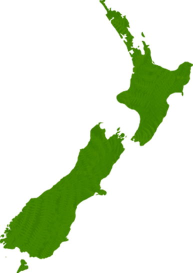
North Island
South Island
- Central Otago
- Auckland
- Bay of Plenty
- Christchurch
- Dunedin
- Coromandel
- Gisborne
- Fiordland
- Hawkes Bay
- Marlborough Sounds
- Manawatu
- Nelson & Golden Bay
- Northland
- North Canterbury
- Queenstown
- Rotorua
- South Canterbury
- Taranaki
- Southland
- Taupo
- Wanaka
- Waikato
- Wellington
- West Coast
- Whangarei
- Bay of Islands
- Tauranga
- Gisborne
- Hamilton
- Napier
- Kapiti
- Palmerston North
- Whanganui
- New Plymouth
- Arrowtown
- Te Anau
- Akaroa
- Ashburton
- Hanmer
- Kaikoura
- Methven
- Mt Cook
- Oamaru
- Tekapo
- Timaru
- Abel Tasman
- Motueka
- Nelson Lakes
- Blenheim
- Picton
- Catlins
- Gore
- Stewart Island
- Central Plateau
- Invercargill
- Cromwell
- Greymouth
- Hokitika
- Westport
- Glenorchy
Our favourite destinations…