North Canterbury, Walks & Parks
-

Kaikoura Peninsula Walkway
The track crosses the peninsula’s clifftop, with excellent views of the Seaward Kaikoura Range, ocean and coastline, to South Bay. It returns to the township via South Bay and Toms Track. Potential to observe wildlife including seals and sea birds.
This family friendly walk can be done in parts or if you want to explore the entire walk allow 3 hours.
read more- Location: Kaikoura peninsula
-

Devils Punchbowl Walking Track - Arthur's Pass
Feel the full force and sound of fresh mountain water falling 131 m down one of New Zealand’s most stunning waterfalls. It's one of our best short walks. 2 km return via same track- 1 hr return. The track starts at the northern end of Arthur's Pass village, just off SH73 at the Punchbowl car park (signposted off the highway). From the start of the walk, follow the footbridge across the Bealey River. The next bridge, over Devils Punchbowl Creek, has a good view of the waterfall. From here, wander through lush beech forest with friendly fantails/pīwakawaka and tomtits before climbing 150 m up a series of steps to a viewing platform at the base of this spectacular waterfall. Return on the same track.
read more- Location: Northern end of Arthur's Pass village, just off SH73 at the Punchbowl car park
-

Craigieburn Forest Park and walking tracks
Short walks in Craigieburn Forest Park range from a 20 minute nature walk to a 3-4 hour walk to the top of Helicopter Hill. About 110 km from Christchurch on SH 73 towards Arthur’s Pass, is a signposted side-road to the Craigieburn picnic area on the Broken River ski field road. This picnic area provides nice spots to have lunch, explore and paddle in Cave Stream. From here you can walk along the road to the Environmental Education Centre (suitable for buggies and strollers) and the start of the Craigieburn Nature Trail (20 minutes return) a pleasant walk through mountain beech forest.
read more- Location: 110 km from Christchurch on SH 73 towards Arthur’s Pass.
-

Kura Täwhiti / Castle Hill Conservation Area
Kura Täwhiti is an ideal place for exploring and picnicking, with many informal trails running around and between the spectacular limestone rock formations. Allow plenty of time to explore. Located beside SH 73, about 80 minutes from Christchurch, the short walk into the reserve ( 10 mins) is across private paddocks.
read more -

Mt. Thomas Conservation Area
The Mt. Thomas Conservation area offers a wide variety of trails making this an ideal destination to spend a few hours or an entire day exploring. Options included the Kereru Track which is an hour return to longer missions to the Mt. Thomas Summit - 3 hours one way.
read more- Location: 392 Glentui Bush Rd, Glentui 7495
-

Peel Forest Park Scenic Reserve
Peel Forest is located in the foothills of the Southern Alps; turn off SH 72, about 12 km north of Geraldine. Once at the forest, a wide variety of short and long tracks extend into the park but for littlies choose the beginning of the Big Tree Walk, which is suitable for prams and wheelchairs.Explore the largest reserve in the Geraldine area on a variety of tracks. Base yourself at the campsite and take your time.
read more- Location: Peel Forest is accessed from Rangitata Gorge Road and from Blandswood Road.
-

Cave Stream Scenic Reserve
This really is a hidden gem, and an adventure activity with older children that is FREE! You can opt for either the above ground 30 minutes return for each track, or add the cave walk through water if the conditions are right. The reserve is well signposted off SH 73 between the Broken River road bridge and Craigieburn Forest Park entrance. Two short, but steep tracks lead from the reserve car park to the cave entrances. You will need to help or carry little ones in a child carrier pack. The easier track to the upstream entrance goes through a karst (limestone) landscape of sculptured rock formations. The other track leads to the edge of a terrace and then drops steeply down to the junction of Cave Stream and Broken River. The limestone formations nearby were the settings for the filming of The Chronicles of Narnia. The 600-metre cave walk itself is not suitable for little children, but is a great adventure for older families that are well prepared, with torches, warm gear and plenty of dry clothes to change into. A separate brochure describes the cave adventure. Note: Do not attempt to enter the cave if the stream is high, with the water discoloured or foaming.
read more- Location: Castle Hill 7580, SH73 between the Broken River road bridge and Craigieburn Forest Park entrance.
-

Hanmer Forest Park
Various choices for walks up to an hour in return or a short 5 minute stroll. Many walks will include species of Douglas fir, poplar and redwood trees. Streams, flax wetland and ponds with associated bird and aquatic life are also accessible here. A popular family one is Woodland Walk - 45 minutes round trip, 2.8 km. This loop walk starts and ends at the DOC picnic area on Jollies Pass Road. Jollies Pass Road is on the right as you drive through Hanmer, just before the Heritage Hotel. The well-formed track is suitable for strollers/young children and passes through woodland forest, meadowland and stands of exotic trees including Douglas fir, poplar and redwood. There are many nice grassy areas to picnic on and run around. The ponds are great places to feed the ducks but take care of children around these. Dogs are permitted but must be kept on a lead.
read more-
Location:
32 River Road
Rangiora 7400
-
Location:
32 River Road
-

Glentui Waterfall and Nature Trail Loop
From the Glentui picnic area there are a few options. Two great family friendly ones are to visit the Glentui waterfall or follow the Glentui Loop Nature Track. The waterfall track takes 30 minutes and offers an impressive view of the river and the waterfall. The Nature Loop is 1 hour return and it descends down to the Glentui River before intersecting with a couple other trails and then heading back to the picnic area.
read more- Location: Glentui Bush Rd, Glentui 7495
-

Conical Hill
This is a popular track in the Hanmer Forest Park. 1 hr return, the 550m summit offers views of the Hanmer Basin.
read more- Location: Conical Hill Walkway, Hanmer Springs 7334
-

Point Kean Seal Colony Walk - Kaikoura
A 50 min (4.4 km one way) scenic walk to see seals in their natural environment, with a bit of history along the way. From the town centre, follow the footpath and road verge along The Esplanade, Avoca Street and Fyffe Quay to Point Kean. On the way, look out for the interpretation signs on The Esplanade opposite Brighton and Margate Streets, telling stories of 'Life on the edge', a community living by the sea — the land, the sea and the people. At Avoca Street, the sign takes you back to 1909, when the new wharf was built. Near Fyffe House, a sign details the early European settlement in Kaikoura and, at nearby Armers Beach, the story tells of the importance this site holds for the local community, both past and present, for the shelter it provides. Near Point Kean car park, there are signs warning that seals are likely to be present in the surrounding area. Most of the seals in the car park are males.. The seals on the rocky platforms out from the car park are females and their pups. For your safety and to avoid disturbing the seals, remain 10 m from any seal in the vicinity of the car park. There are toilets at the car park.
read more- Location: 40 Fyffe Quay, Kaikoura 7300
-

Chatterton River Track
2 hr 30 min return. The Chatterton River Track provides something a little different to the other walks in the Hanmer Forest region in that it is less visited, a little remote, and has an seclusion not easily found along the more popular walks. Beginning on Chatterton Road, about 1.2km north of the Alpine Adventure Camp (there is a gate here that is sometimes locked making it necessary to walk this section as well), the track heads down to the stream which it then follows all the way to the valley head. Higher up mature stands of mountain beech will be encountered as well as groves of ferns and some relatively steep sections of track as the route makes its way up the south face of Jacks Pass to the broad summit. At the pass there is a spectacular view here of the Hanmer Range peaks and over into the Clarence Valle.
read more- Location: Chatterton Road, about 1.2km north of the Alpine Adventure Camp
-

Arthur’s Pass Walking Track
Experience the best of Arthur’s Pass's diverse alpine vegetation, waterfalls, wetlands, rich history and stunning mountain views on this walk. 2 h 40 min (6.8 km) return via same ... read more
- Location: Start at the Punchbowl, Bealey Chasm (Jacks Hut) or Temple Basin car parks.
-

Hinau Walk Loop Track
Awell-formed track that is suitable for families. The loop takes you through an unusual forest with a number of Hinau trees, Mahoe, Putaputaweta, Broadleaf, Tree Fushcia and Pigeon... read more
- Location: Take Postmans road to Mount Fyffe carpark, Kaikoura
-

Waterfall Track - Hamner
Climb through mountain beech forest to the spectacular 41 metre high Dog Stream Waterfall. The winding and moderately steep trail begins at the top of McIntyres Road (accessed off Jollies Pass Road) and heads up the stream edge through dense native forest. The walk is interesting and varied as it traverses the watershed just above the deep gutter of Dog Stream, (parents with young children need to take care at several places along this track), climbing up wooden stairways in the forest and sidling along small cliff faces to reach the rock face and small basin into which the waterfall plummets. A suggested round trip is to return via the Spur Track and Fir Trail.
read more- Location: McIntyres Road (accessed off Jollies Pass Road), Hamner
North Island
South Island
- Central Otago
- Auckland
- Bay of Plenty
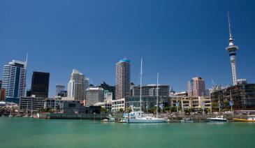
- Christchurch
- Dunedin
- Coromandel
- Gisborne
- Fiordland
- Hawkes Bay
- Marlborough Sounds
- Manawatu
- Nelson & Golden Bay
- Northland
- North Canterbury
- Queenstown
- Rotorua
- South Canterbury
- Taranaki
- Southland
- Taupo
- Wanaka
- Waikato
- Wellington
- West Coast
- Whangarei
- Bay of Islands
- Tauranga
- Gisborne
- Hamilton
- Napier
- Kapiti
- Palmerston North
- Whanganui
- New Plymouth
- Arrowtown
- Te Anau
- Akaroa
- Ashburton
- Hanmer
- Kaikoura
- Methven
- Mt Cook
- Oamaru
- Tekapo
- Timaru
- Abel Tasman
- Motueka
- Nelson Lakes
- Blenheim
- Picton
- Catlins
- Gore
- Stewart Island
- Central Plateau
- Invercargill
- Cromwell
- Greymouth
- Hokitika
- Westport
- Glenorchy
Our favourite destinations…