Central Otago, Walks & Parks
-

Naseby Swimming Dam
The swimming dam is located across from the campground on Swimming Dam Road. It is filled each year from the water race and is a popular spot for swimmers of all ages. There are plenty of shallows for the youngsters at one end, and a lovely deep hole and diving board for the older children, at the other. Coalpit and Hoffman Dams are also suitable for swimming.
read more- Location: 13 Swimming Dam Road
-

Quartz Reef Point Walk
A 30 min walk to Quartz Reef Point, the best preserved example of herring bone tailings in the country. From the carpark, cross the road and and follow the marker poles to the right. This is through private property. At the top of the rise there's a gate into the historic reserve and the track leads to a viewing platform. From here there are views of the tailings and over to Lake Dunstan, Cromwell and the Pisa Range. These virtually pristine remains are the result of ground sluicing; channeling water to the head of a claim and flooding the working face. Larger stones and rocks were removed and stacked, row after row in a herring bone pattern. The washed material was then directed or shoveled to a sluice channel to separate the gold from the gravel.
read more- Location: Cromwell-Lindis Pass Highway, by Lake Dunstan, between Cromwell and Tarras.
-

Cairnmuir Track - Cromwell
The Cairnmuir track follows the range of the same name and runs from Cromwell to Clyde on the south side of the Cromwell Gorge. Because of its central location it has 360 degree views and on a clear day mountain peaks many kilometers away may be seen. There is a 6km (2.5hr) walk which provides wonderful views of the Cromwell area and the mountain ranges beyond. The track starts at the Conservation Department sign on Cornish Point Road, reached by turning into Cairnmuir Road just over the Bannockburn Bridge. This is vineyard territory and there are options to stop and enjoy food and wine along the way before or after your walk.
read more
The track winds steeply up the hill and when a small saddle is reached, goes through the gate up the main ridge on an old four wheel drive track. There are markers to guide you the whole way. This is an arid landscape with wild thyme predominating in many places. 3 km up this track, just before a small descent, there is a good place to stop, soak in the view, have a bite to eat, and then return the way you came. All the way down the views are spectacular and combined with the fragrance of thyme this is a memorable Central Otago walk.
- Location: Cairnmuir Road, just over the Bannockburn Bridge, Near Cromwell
-

Bannockburn Sluicings
It is a 3.5km, 2 hour walk and can be hot and dry. This track loops around the former Bannockburn gold field to provide a vivid slice of history and a most rewarding perspective of times gone by. The area was sluiced and mined from 1862 to the 1930’s with the remains of dams, water races, tunnels, stone walls, and channels to be seen. Towering cliff faces are all that is left of hills that have been sluiced away to find the precious gold. Good footwear and a drink are essential.
read more- Location: 143 Felton Rd, Bannockburn 9384
-

Bendigo Walks
High on the hill is Bendigo a former bustling hard rock gold-mining area - now a beautiful mining ghost town with walks, mining ruins and amazing scenery. There are two main walks... read more
- Location: Bendigo Station, Central Otago
-

Naseby Forest Trails
Naseby Forest is a privately owned working forest that will be closed from time to time for logging or if fire danger is high so check ahead. Grab a map from the information centre or local shop. Heaps of mountain bike trails for all levels, a great family friendly one follows the Mount Ida water race.
read more-
Location:
Forestry Rd
Naseby 9396
-
Location:
Forestry Rd
-

Shaky Bridge to Clock - Alexandra
The clock in Alexandra has been an icon since 1968. It's a 20 minute return walk up the rocky path to the 11m clock.
read more-
Location:
Kerry St
Bridge Hill
Alexandra 9320
-
Location:
Kerry St
-

Alexandra - Clyde River Track
This Central Otago walk follows the Clutha River on the true right bank between Alexandra and Clyde. Although graded as ‘easy’ it is 12.8km and will take 3-4 hours to complete. It is a popular walking and cycle track, with sections suitable for pushchairs or wheelchairs. The track stays within 20 meters of the river and mostly in the shade of large willow trees. A fantastic walk or bike with the kids for a day out and especially good in the height of summer when shade is appreciated. There are numerous spots to stop and picnic or just enjoy the ambiance.
read more- Location: Earnscleugh Bridge
-

Otago Rail Trail - Highlights
A flat easy walk/bike that you can jump into a section of we recommend the Auripo to Lauder (10.5 km) section. Start at the old Auripo Road Station site – and you can easily walk or cycle through one of the Trail’s special highlights, the Poolburn Gorge. The Trail here is flat or gently downhill – the Poolburn Viaduct, two tunnels, a secluded gorge where you can have a picnic lunch – or you can go for a swim at the longest bridge on the Trail (Manuherikia Bridge) near Lauder. Another option is to start at Lauder, cycle up through the Poolburn Gorge to the Viaduct and return to Lauder.
read more- Location: Lauder, 27km from Alexandra via State Highway 85
-

Clyde Township Lookout Track & Holloway Street Reserve
Within a short stroll from the historic precinct of Clyde is this great track with fantastic views of the township and surrounding area. Access is from the Holloway Street Memorial - situated at the base of the hill at the northern end of Clyde’s historic precinct is this small reserve with its miners’ memorial commemorating the gold miners who lost their lives in the 1800s. This small reserve is an ideal spot to have lunch or rest after having a stroll around Clyde’s historic precinct. From here the benched track zigzags up the hillside for about 500 metres. For the average person the walk to the top should take about 5 to 10 minutes and once there you have the option of walking back down or to continue along the hillside and loop back down Sunderland Street. Another option is to take a walk down Miners Lane to the Clutha Mata-au River.
read more- Location: Holloway Street, Clyde
-

Horseshoe Bend Track, Roxburgh
This track ( 1.5 hour return) leads to an historic suspension bridge over the Clutha River. The village once here in this gold mining area was known as Rigney and the miner’s children needed to cross the river to get to school. Rather than brave the swift current with a boat, first a wire cage was installed but when this proved difficult, the bridge you see today was constructed in 1913. It is remote and can be a wild area but the peacefulness and spectacular river views are well worth the effort getting here. Take care on the bridge but enjoy crossing before returning the same way. Access from SH8 through the area known as Island Block. This route has excellent views of the river and recent gold dredge ponds. Whilst in this area, drive 1 km further on this road and view the ‘Lonely Graves’, located beside the road with a car park adjacent. There are two graves here. According to the story in 1865 William Rigney found the body of a good looking young man in the river. He buried it here with the headboard inscribed ‘Somebody’s Darling lies buried here’. When William died in 1912, he was buried beside ‘Somebody’s Darling’.
read more
-

Walk around Historic Ophir
Originally the township was known as Blacks, after Charles Black on whose run gold was first discovered. The name was changed to the more apt, Ophir in 1875 after the biblical land where the Queen of Sheba obtained gold for King Solomon. At its height, Ophir’s population surged to more than 1000 people. The Ophir Post Office opened for business in 1886 and has changed little since its original construction. It still opens for 3 hours every week day. Most of the buildings are now privately owned, but views from the street are still very rewarding. Take a walk down Swindon Street. A local brochure outlines the stone kerbing, the Post and Telegraph Office, courthouse and jail, bakery, cottages, church and shops - that makes it really interesting.
read more
The suspension bridge, built in 1880, was once the main means of crossing the Manuherikia River and is one of only a few remaining in Central Otago.- Location: Ophir is just 24kms from Alexandra and a 2km detour south, off State Highway 85 at the town of Omakau.
-

Blue Lake Loop - St. Bathans
There are a couple of options around the Blue Lake area in St. Bathans - the 2km, 50 min option will take you on a loop that skirt a portion of Blue Lake. A 3km, 90min return option will take you all the way around Blue Lake.
read more-
Location:
Blue Lake
St Bathans 9386
-
Location:
Blue Lake
-

Gabriel's Gully - Lawrence
The Otago Dam walk is a medium grade walk over 2.7km which will take you around 1hr to get to. Total round trip walk is about 2 hours. Otago Dam is in the heart of Gabriel's Gully, one of the richest and longest lasting gold fields in central Otago. 4,000 gold miners worked the Gabriel's Gully gold fields in 1860. A water race ran from Otago Dam down to Gabriel's Gully for hydraulic elevating.
read more- Location: 3 km from the township of Lawrence, 92 km south-west of Dunedin on SH8.
North Island
South Island
- Central Otago
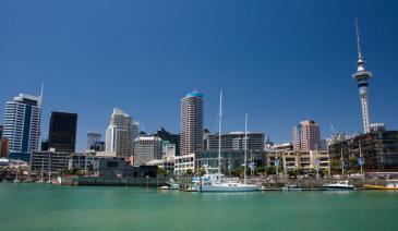
- Auckland
- Bay of Plenty
- Christchurch
- Dunedin
- Coromandel
- Gisborne
- Fiordland
- Hawkes Bay
- Marlborough Sounds
- Manawatu
- Nelson & Golden Bay
- Northland
- North Canterbury
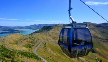
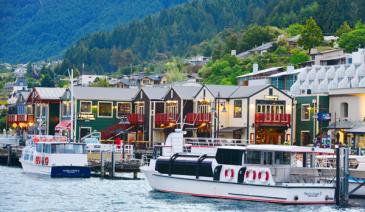
- Queenstown
- Rotorua
- South Canterbury
- Taranaki
- Southland
- Taupo
- Wanaka
- Waikato
- Wellington
- West Coast
- Whangarei
- Bay of Islands
- Tauranga
- Gisborne
- Hamilton
- Napier
- Kapiti
- Palmerston North
- Whanganui
- New Plymouth
- Arrowtown
- Te Anau
- Akaroa
- Ashburton
- Hanmer
- Kaikoura
- Methven
- Mt Cook
- Oamaru
- Tekapo
- Timaru
- Abel Tasman
- Motueka
- Nelson Lakes
- Blenheim
- Picton
- Catlins
- Gore
- Stewart Island
- Central Plateau
- Invercargill
- Cromwell
- Greymouth
- Hokitika
- Westport
- Glenorchy
Our favourite destinations…