Walks & Parks
-

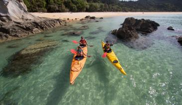
Waiheke Island
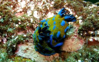
Forest, cascading streams and safe beaches – Waiheke Island has it all. Book a picnic site on the beach at Whakanewha Regional Park on the south side of the island which has a crescent-shaped beach with warm, shallow water ideal for children at high tide. Or try Onetangi, Waiheke’s biggest ocean beach with a long, sandy beach, safe swimming, and places to eat.
read more- Location: Ferry to Waiheke Island. Whakanewha is about 20 mins drive from the wharf. Shuttle buses available.
-

Walk around Historic Ophir
Originally the township was known as Blacks, after Charles Black on whose run gold was first discovered. The name was changed to the more apt, Ophir in 1875 after the biblical land where the Queen of Sheba obtained gold for King Solomon. At its height, Ophir’s population surged to more than 1000 people. The Ophir Post Office opened for business in 1886 and has changed little since its original construction. It still opens for 3 hours every week day. Most of the buildings are now privately owned, but views from the street are still very rewarding. Take a walk down Swindon Street. A local brochure outlines the stone kerbing, the Post and Telegraph Office, courthouse and jail, bakery, cottages, church and shops - that makes it really interesting.
read more
The suspension bridge, built in 1880, was once the main means of crossing the Manuherikia River and is one of only a few remaining in Central Otago.- Location: Ophir is just 24kms from Alexandra and a 2km detour south, off State Highway 85 at the town of Omakau.
-

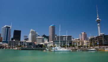
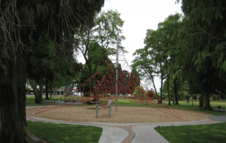
Waitangi Park
Previously known as Chaffers, this newly re-created recreation space is close to Te Papa. The facilities include a waka launching area, a children’s playground, skateboard zone and plenty of grass to run around on.
read more- Location: Wellington Waterfront
-

Devil's Punchbowl Waterfall - Arthur's Pass
Just outside of the Arthurs Pass village (on the West Coast side) are a number of reasonably short and easy walks, including the half hour track to the Devils Punchbowl Falls. A large bridge first takes you over the rocky river before the path winds up through the bush. The track is easy to follow and in good repair. Rocky in parts, some care needs to be taken as you clamber over tree roots, but much of the track has been set with board walk and steps. The bush scenery is lush and stunning, and as you arrive at the falls, a viewing platform gives you a good view of the Devil’s Punchbowl.
read more -
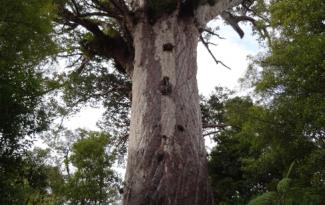
Trounson Kauri Park - nr Dargaville
Take a walk through this park to view the wonderful forest and beautiful kauri trees. The track is easy and takes about 30 to 40 minutes. The park is managed by the Department of Conservation. During the day you can see kukupa (New Zealand’s only native pigeon), fantails and morepork. Or a guided nightwalk will give you the opportunity to see the forest at night and maybe see kiwi or bats.
read more- Location: Off State Highway 12, 30 mins north of Dargaville
-

Hawkes Bay - Lake Tutira
Forty kilometers north of Napier is Lake Tutira. The area surrounding this lake is a bird sanctuary and makes a wonderful picnic and camping spot. There are toilet facilities and a free campsite with fresh water and barbecue facilities. The Tutira walkway is steep and not suitable for young children or pushchairs (the round trip takes about five hours!), but there is good swimming in this very pretty lake and trout fishing in the lake’s northern reaches.
read more- Location: Between Napier and Wairoa
-

Observation Rock - Stewart Island
From the DOC Visitor Centre turn right towards the waterfront, continue right until you reach Excelsior Road on your right. Excelsior Road is an uphill climb, watch for the Observation Rock track sign on your right at the summit of the hill, a short forest track leads you to the rock forming the lookout, with great views over Paterson Inlet, particularly at sunset. To return to Halfmoon Bay retrace steps to the road and continue right, down the hill towards Golden Bay Road. A right hand turn will bring you back to town past Traill Park. Look out for Tui, with the distinctive white feather, or ruff, below its beak.
read more- Location: Stewart Island, off Excelsior Road
-

Kea Point Track - Mount Cook
Located in the Aoraki/Mount Cook village this walk winds it's way through subalpine grasslands and scrub to the Mueller Glacier moraine wall. It's a 1 hour return if you start from the Whitehorse campground and carpark, or 2hrs if you start from the village. It's an out and back that ends with stunning views of Mount Cook.
read more- Location: Aoraki Mount Cook National Park (Te Wahipounamu), New Zealand
-
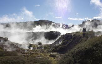
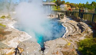
Taupo - Craters of the Moon
The Craters of the Moon is an area of thermal activity with boiling mud pools, steam vents and interesting plants which have adapted to thrive in the hot, steamy conditions. Boardwalks and pathways have been created to lead spectators safely through this area and the walk will take you around 60 minutes. There is an information office and shop on site.
read more- Location: Wairakei Tourist Park
-

Lake Chalice Hut tracks
Explore the area around Lake Chalice, the only lake in Mount Richmond Forest Park - the short, easy walk (1 hr to hut / 2 hr 30 min loop) to the hut is ideal for an overnight tramp with children.
read more- Location: 5 km north Renwick (just over the Wairau River bridge) turn off SH6 onto Northbank Road. Follow this for 33 km then turn into Top Valley Road. Continue for 6 km then turn into Staircase Road and follow this for 18 km to the car park.
-

Naseby Forest Trails
Naseby Forest is a privately owned working forest that will be closed from time to time for logging or if fire danger is high so check ahead. Grab a map from the information centre or local shop. Heaps of mountain bike trails for all levels, a great family friendly one follows the Mount Ida water race.
read more-
Location:
Forestry Rd
Naseby 9396
-
Location:
Forestry Rd
-
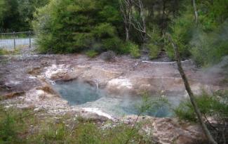
Taupo -Tokaanu Thermal Area
Just five minutes from Turangi is the village of Tokaanu. A short walk around the loop track on well formed paths and boardwalks allows you to see steaming hot mineral pools and bubbling mud pools. Take a picnic with you as there are areas for picnics and fishing. You can swim in the nearby Tokaanu Thermal pools at Mangaroa Street and there are often rainbow trout swimming in the cold Tokaanu stream which flows beside the thermal area. As with all thermal area, children should be supervised at all times.
read more- Location: Tokaanu Thermal Area, SH41, Lake Taupo
-

Te Apiti Wind Farm - Palmerston North
The views from here are worth the visit, on clear days you can see as far as Mt Ruapehu, Mt Taranaki and out across the horizon. You can stand directly beneath a turbine and read all about how they work. With giant turbine blades whirring overhead, these surreal machines are quite a spectacle to behold.
read more- Location: Woodville 4999
-

Sandy Point Domain - Invercargill
Located 7km west of Invercargill, drive to Oreti Beach on Dunns Road. The domain entrance is just after the Oreti River bridge and consists of over 2000 hectares of dunes, beach and bush. Also of interest is the ancient sand dune forest of wind sculptured Totara and Matai. The domain features several toilets and picnic/BBQ areas, and there are two playgrounds located in the Sandy Point Domain. Sandy Point is popular for various local activities or clubs: horsetrekking, kayaking, motor sports, mountain biking, paintball, rugby, rodeo, shooting sports, surf life saving and water skiing. There are also around 14km of walking tracks, making it easy to explore Sandy Point on foot. Example walks: Hatches Hill Lookout (5 minutes, one way) The track is signed at the turn off to Noki Kaik Beach. The lookout provides panoramic views across the New River Estuary to Invercargill and south to Bluff and Stewart Island. The track continues to the picnic area at Noki Kaik (15 minutes one way). Daffodil Bay to Hatches Hill (45 minutes one way) the track entrance is signed from the picnic area. It combines good estuary views with the unusual Totara-Matai forest so characteristic of this area. McShanes Track (25 minutes return) starts opposite the settlement of Cooper’s Creek and passes through an attractive remnant of native forest. At the Loop Road, cross the traffic barrier and turn left to return to Coopers Creek.
read more- Location: Invercargill, Sandy Point, 7km west of Invercargill, nr Oreti Beach
-
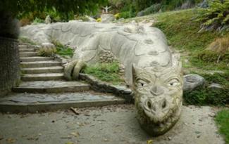
Te Puna Quarry Park - Bay of Plenty
This family friendly park is being developed by volunteers from a disused quarry into a world class park. There are ponds, tree ferns and other plants plus stone sculptures by local artists. The walking tracks are easy for the moderately fit. Open every day during daylight hours.
read more- Location: Te Puna, Quarry Road, Bay of Plenty
-

Queens Park - Invercargill
80 hectares (200 acres) of gardens and parkland, minutes from the city centre and next to the main tourist information centre and Southland museum. Queens Park also has an impressive bird aviary, animal enclosures, children’s play areas, extensive sporting facilities, 18 hole golf course, observatory and cafes. Also prominent on the ground is the Southland Museum and Art Gallery. There is a 4 km fitness trail for the energetic, otherwise there are numerous paths and tracks throughout the park.
read more- Location: Invercargill - Queens Park, Gala Street
-

Hahei Beach - Whitianga
This attractive, white sandy beach with pohutukawas is one and a half kilometres long. The crystal clear water is home to crayfish and fish. At the eastern end of the beach is the site of an old Maori Pa. From the lookout there is access to Cathedral Cove and the marine reserve. There are cafes, a beach store, ice cream parlour and gift shop nearby.
read more- Location: Hahei, South of Whitianga
-

Peel Forest Park Scenic Reserve
Peel Forest is located in the foothills of the Southern Alps; turn off SH 72, about 12 km north of Geraldine. Once at the forest, a wide variety of short and long tracks extend into the park but for littlies choose the beginning of the Big Tree Walk, which is suitable for prams and wheelchairs.Explore the largest reserve in the Geraldine area on a variety of tracks. Base yourself at the campsite and take your time.
read more- Location: Peel Forest is accessed from Rangitata Gorge Road and from Blandswood Road.
-
Hawkes Bay - Te Angiangi Marine Reserve -
The Te Angiangi Marine Reserve was established in 1997 and covers an area of about 446 hectares between Blackhead and Aramoana beaches. The reserve, which protects this part of the coast, offers opportunities for swimming, walking, shore diving and boating. Between Blackhead and Paoanui Point at low tide birds like kingfishers, oyster catchers and godwits can be seen. Explore the rock pools to find fish, crabs and kina (but return any rocks to their original position) or snorkel in the sheltered waters of Stingray or Shelly Bays and discover reef animals like paua, opal shells and rock lobsters.
read more- Location: Central Hawkes Bay,30 km east of Waipukurau and Waipawa
-
Taupo -Tongariro Domain
Tongariro Domain has a playground which is suitable for children and there are picnic tables. The Domain’s toilets also offer a parents’ room with a changing table and microwave, sink and toys for the children. The Lion’s Club operates children's rides on the Domain on a small monorail, weather permitting, for $1 per person. Check with the Visitor Centre for train times during the winter months.
read more- Location: Tongariro Road, Lakefront, Taupo
-

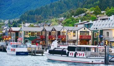
Frankton Beach Picnic Area - Queenstown
Picnic tables, BBQ area, toilets, short walk to playground plus, since it’s so shallow, the warmest part of Lake Wakatipu. Jetski hire from Frankton Marina.
read more- Location: Queenstown - Frankton Beach
-

Hastings - Te Mata Peak Lookout
Good, sealed road to the top of this impressive hill, that winds up on one side, and drops straight down in a sheer bluff on the other. Impressive 360 views from the top, of the whole Hawkes Bay region, and on a clear day you can see as far as Mount Ruapehu. Scattered, tiny, below are some of the fabulous wineries of the Hawkes Bay district, along with the Te Mata cheesery.
read more -

Te Kopua Beach - Raglan
This is the safest beach in Raglan for swimming. It is accessible from either the road or from the footbridge at the lower end of Bow Street. The beach is black-sand but is popular with families. There is a children’s playground.
read more- Location: Over footbridge by holiday park, Raglan
-

Millennium Walkway - Wanaka
Gentle ups and downs as you follow the lakeshore, finishing at a secluded bay – ideal picnic /swim spot.
read more- Location: Wanaka - Take the Mount Aspiring Road out of town towards Glendhu Bay. The track is well signed on the right hand side, just a few kilometres along this road.
North Island
South Island
- Central Otago
- Auckland
- Bay of Plenty
- Christchurch
- Dunedin
- Coromandel
- Gisborne
- Fiordland
- Hawkes Bay
- Marlborough Sounds
- Manawatu
- Nelson & Golden Bay
- Northland
- North Canterbury
- Queenstown
- Rotorua
- South Canterbury
- Taranaki
- Southland
- Taupo
- Wanaka
- Waikato
- Wellington
- West Coast
- Whangarei
- Bay of Islands
- Tauranga
- Gisborne
- Hamilton
- Napier
- Kapiti
- Palmerston North
- Whanganui
- New Plymouth
- Arrowtown
- Te Anau
- Akaroa
- Ashburton
- Hanmer
- Kaikoura
- Methven
- Mt Cook
- Oamaru
- Tekapo
- Timaru
- Abel Tasman
- Motueka
- Nelson Lakes
- Blenheim
- Picton
- Catlins
- Gore
- Stewart Island
- Central Plateau
- Invercargill
- Cromwell
- Greymouth
- Hokitika
- Westport
- Glenorchy
Our favourite destinations…