Walks & Parks
-

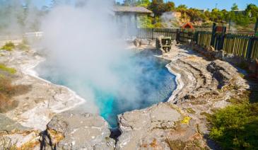
Te Waikoropupu Springs
read moreFollow State Highway 60 north from Takaka on the road to Collingwood, turning left just beyond Takaka River. Follow Pupu Valley and Te Waikoropupū Springs roads to the springs’ car park, 7 km from Takaka.
Te Waikoropupū Springs are New Zealand’s largest freshwater springs and the largest coldwater springs in the southern hemisphere. They contain some of the clearest water ever measured and are set in a reserve
that protects gold workings, regenerating forest and a fine patch of mature bush. To Māori the area of Te Waikoropupū is a taonga or treasure and a wāhi tapu, a place held in high cultural and spiritual regard, both locally and nationally. The legends of Te Waikoropupū are told in the stories of Huriawa, its taniwha (guardian spirit). In Māori tradition the springs are waiora, the purest form of water and provide water for healing. In the past, the springs were a place of ceremonial blessings at times of birth and death and the leaving and returning of travellers. A platform that sits partly over the water allows visitors to get a good view of the springs. A suite of interpretation signs at the entrance way tells the full story of this fascinating and beautiful place. Well-formed walking tracks allow you to explore the reserve. Allow 30–45 mins to visit the springs and return. It is worth spending extra time to enjoy the interpretation signs at the entrance.- Location: Pupu Springs Rd, Takaka 7183
-

Arthur’s Pass Walking Track
Experience the best of Arthur’s Pass's diverse alpine vegetation, waterfalls, wetlands, rich history and stunning mountain views on this walk. 2 h 40 min (6.8 km) return via same ... read more
- Location: Start at the Punchbowl, Bealey Chasm (Jacks Hut) or Temple Basin car parks.
-

Knuckle Hill Track
Head west from Pakawau over the Pakawau Saddle and down to Whanganui Inlet. Dry Road leads around the inlet, crossing several tidal streams before climbing to a car park at a saddle with a great view of the inlet mouth. Knuckle Hill Track is signposted from the car park. This aptly named hill provides the only elevated viewpoint over Whanganui Inlet, a huge estuary declared a marine reserve and wildlife management reserve in 1994. From the car park, an old logging road climbs gently through regenerating forest to a clearing, where there is plenty of space to relax and picnic. This 5.6-kilometre section of road takes about one hour to walk or a little less to mountain bike. At the clearing, the marked route up Knuckle Hill begins — a short climb of 20 minutes. From the top, right on the boundary of Kahurangi National Park, are excellent views of the top of the South Island, particularly Farewell Spit and Whanganui Inlet.
read more- Location: Knuckle Hill, Kahurangi National Park 7073
-

Speargrass Track Hut
For an easy overnight tramp, great for kids, walk to Speargrass Hut on this well graded track. 2 hr 30 min one way - this well graded track descends gradually from the carpark. It follows the river along the valley floor then climbs up through beautiful beech forest to Speargrass Hut ( 12 bunk beds) – set in clearing with mountain views.
read more- Location: Mt Robert Road, off SH 63 east of St Arnaud.
-

The Dunedin Chinese Garden
A perfect miniature of a traditional Chinese landscape painting, it's origins come from a desire to celebrate the city’s Chinese heritage and its valuable sister city relationship with Shanghai.
The Garden changes with the seasons and vistas and hidden corners appear unexpectedly so you see something different every time you visit.
Bring a picnic, try some puzzles and games or simply wander and soak up the tranquility of the only authentic Chinese Scholar’s Garden in the Southern Hemisphere.
read more- Phone: 03 477 3248
- Location: Corner of Rattray and Cumberland Streets, Dunedin
-

Cable Bay Walkway
Enjoy the coastal views on this walkway between Rotokura/Cable Bay and The Glen, near Nelson. Boating, sea kayaking, and snorkeling are all possible. Cable Bay Walkway extends from Glenduan to Cable Bay, north of Nelson City. The hilly coastal track passes through a mix of pasture, pine forest and native forest, and provides impressive views of Tasman Bay and Cable Bay. The walk can be completed in either direction and is best enjoyed if you have someone to pick you up at the other end. The complete walk takes about 3½ hours one way, and requires transport arrangements to be made. From the Rotokura/Cable Bay end a shorter return trip is to the top of the first hill (1 hr return) or to the forest edge (2 hr return). From the Glen end, a round trip to the airstrip and back takes about 2 hours. Cable Bay Walkway offers wonderful coastal views of the Boulder Bank, Nelson City and Kahurangi and Abel Tasman National Parks. The middle section of the track passes through a patch of beautiful and varied native forest.The track is a walking track. It is steep in places and strong footwear is recommended.
read more- Location: Airlie St, Glenduan, Nelson
-

Godley Head (Port Hills)
From Sumner or Lyttelton, take the Summit Road out to the headland to explore the relics of a WWII coastal defence battery. Older children will enjoy the Tunnel Walk (1 hour return) but note the track down to the tunnel is very steep and slippery when wet. Littlies may prefer to just explore around the old gun emplacements and underground magazines (take a torch). Children must be supervised as the steps down to the magazines are steep.
read more- Location: Godley Head, Summit Road, Christchurch
-
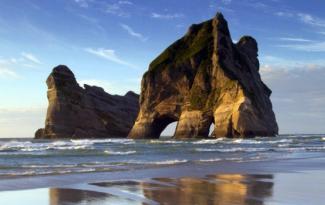
Farewell Spit - Wharariki Beach
One of the most beautiful beaches in the region – huge sand dunes, lagoon, caves, seals, birdlife and no roads nearby! Access is by easy path – from the end of Wharariki Road, walk over farmland and through a section of coastal forest to the beach. Please do not approach seals. Be aware of weather conditions and sea and surf can be rough. Fossil Point Loop – easy 1 hr return From the carpark, walk across Triangle Flat to see fossils in the mudstone and seals in the water. Return via Ocean Beach and a vehicle track. Pakawau Beach Good family swimming beach with shallow, warm waters. 15 minutes north of Colllingwood. Watching the speed of the tide flow into or out of the inlet is an experience in itself!
read more -

Wainui Falls Track
The 30-minute walk to Wainui Falls is popular as accessible waterfalls are not common in Golden Bay. The track starts from a car park in Wainui Bay 20 km north-east of Takaka. Look for the direction sign on the road side approximately 300 metres after crossing over the Wainui River Bridge. From the car park the track crosses farmland for a short distance before entering forest and climbing rapidly to a point where you see the river surprisingly far below. Here you walk through a forest of nīkau palms, rātā trees and ferns. Keep a lookout for a possible sighting of the giant snail, Powelliphanta. Look but don’t touch! A few minutes after crossing the swingbridge over the Wainui River, you will hear the falls before they suddenly appear, usually curtained in spray. Children need to be closely supervised as there are steep drops off the edge of the track in some places. Take a picnic, there are a few little beaches perfect for a swim, picnic and a bit of boulder hopping.
read more- Location: 29 Wainui Falls Rd, Tata Beach 7183
-

Chatterton River Track
2 hr 30 min return. The Chatterton River Track provides something a little different to the other walks in the Hanmer Forest region in that it is less visited, a little remote, and has an seclusion not easily found along the more popular walks. Beginning on Chatterton Road, about 1.2km north of the Alpine Adventure Camp (there is a gate here that is sometimes locked making it necessary to walk this section as well), the track heads down to the stream which it then follows all the way to the valley head. Higher up mature stands of mountain beech will be encountered as well as groves of ferns and some relatively steep sections of track as the route makes its way up the south face of Jacks Pass to the broad summit. At the pass there is a spectacular view here of the Hanmer Range peaks and over into the Clarence Valle.
read more- Location: Chatterton Road, about 1.2km north of the Alpine Adventure Camp
-

Rabbit Island Recreation Reserve - Nelson
A popular beach and picnic spot, 15 minutes drive west of Nelson. The island is reachable by a bridge that crosses the estuary behind the island. Most of the island is pine plantations, with a public picnic area in the middle of the front beach. Toilets, changing rooms and outside showers are at the beach. Also picnic tables and coin operated BBQs. The gates are closed at sunset and overnight stays are not allowed so be ready to leave before it gets dark. There is a large sign near the entrance which lets you know what time the gates will be closing that day (in the middle of summer it’s around 9pm).
read more -

Labyrinth Rocks Walkway
Just two kilometres out of Takaka, on the way to Pohara, are three big oak trees. Turn left here, follow the signs to Labyrinth Rocks Walkway and you will find one of Golden Bay's most amazing places. Nature has produced a maze-like network of canyons through a limestone outcrop " an excellent example of the geological term 'Karst' limestone for which this area is known. It has been developed (and is still in the process of being developed) as an enchanting family attraction. Young or old, you will love exploring all the nooks and crannies - keep younger kids close to you as you can get lost in the maze, older kids will enjoy going off and trying to find their way back. A magical thing to do - is see if you can find little toys and figurines hidden in the rocks - it's the locals kids secret toy swop. So if your child brings their own figure/toy (check out the Salvation Army shop in town), your child can find one they love they can take it and leave theirs in its place! They will be begging to go back the next day.
read more- Location: 7183, 45 Scott Rd, Takaka 7183
-
Waitahinga Trails Whanganui
A range of walks in wild, native bush. The Waitahinga Trails are located about 12 kms past Bushy Park, inland from Kai Iwi Beach, and are a collection of walks in native bush catering for various fitness levels. There are various walks of different lengths that make a great half day or full day outing in the hinterlands of Whanganui!
read more-
Location:
Rangitatau East Road
(Junction Road)
Kai Iwi, Whanganui.
-
Location:
Rangitatau East Road
-

Waterfall Track - Hamner
Climb through mountain beech forest to the spectacular 41 metre high Dog Stream Waterfall. The winding and moderately steep trail begins at the top of McIntyres Road (accessed off Jollies Pass Road) and heads up the stream edge through dense native forest. The walk is interesting and varied as it traverses the watershed just above the deep gutter of Dog Stream, (parents with young children need to take care at several places along this track), climbing up wooden stairways in the forest and sidling along small cliff faces to reach the rock face and small basin into which the waterfall plummets. A suggested round trip is to return via the Spur Track and Fir Trail.
read more- Location: McIntyres Road (accessed off Jollies Pass Road), Hamner
-

Glenfalloch Gardens
Situated in peaceful, relaxing surroundings you can enjoy panoramic harbour views. Stroll among the gorgeous flowers which integrate with native ferns, exotic imports and indigenous NZ trees thato showcase 120 years of conservation and expansion of our botanical heritage. A great place to visit with the family and there is a restaurant onsite open for lunch Thursday-Sunday from 11am-3.30pm.
read more- Phone: 03 476 1006
- Location: 430 Portobello Road Macandrew Bay, Dunedin
-

Sledge Track - Palmerston North
Scenic walk with stunning waterfalls, swimming holes and rock formations along the way - 5-6 hours return.
Starting off as a nice, easy walk ideal for children and families, the Sledge Track offers a great escape into the wild without travelling too far. Walking the track you will see waterfalls and swimming holes, as well as stunning rock formations in the river and scenic picnic spots. After the first 30 minutes or so, just past the Argyle Rocks, the track gradually steepens and is better suited to experienced walkers. For competent trampers, heading right up to the Elevation (1.5 hours in) and onto the Platinum Mines (3 hours in) past a number of old mineshafts makes for a satisfying trek into some of the regions most spectacular scenery.
A new 22 metre swing bridge, added in 2017, has created a loop track. Found approximately 2.5km into the walk, the swing bridge takes you over the gully and into Arapuke Park, a Mountain Bike park. From here, you can return via Checkpoint Charlie Track and Pupurahi, or via the longer 7km route of Arapuke Road and Back Track. Both of these are shared tracks, so please be mindful and giveaway to mountain bikers who can travel at speed.
read more- Location: Car park at the end of Kahuterawa Road (GRAVEL ROAD), which runs off Old West Road in Palmerston North
-

Point Kean Seal Colony Walk - Kaikoura
A 50 min (4.4 km one way) scenic walk to see seals in their natural environment, with a bit of history along the way. From the town centre, follow the footpath and road verge along The Esplanade, Avoca Street and Fyffe Quay to Point Kean. On the way, look out for the interpretation signs on The Esplanade opposite Brighton and Margate Streets, telling stories of 'Life on the edge', a community living by the sea — the land, the sea and the people. At Avoca Street, the sign takes you back to 1909, when the new wharf was built. Near Fyffe House, a sign details the early European settlement in Kaikoura and, at nearby Armers Beach, the story tells of the importance this site holds for the local community, both past and present, for the shelter it provides. Near Point Kean car park, there are signs warning that seals are likely to be present in the surrounding area. Most of the seals in the car park are males.. The seals on the rocky platforms out from the car park are females and their pups. For your safety and to avoid disturbing the seals, remain 10 m from any seal in the vicinity of the car park. There are toilets at the car park.
read more- Location: 40 Fyffe Quay, Kaikoura 7300
-
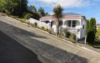
The World's Steepest Street
Baldwin Street, in Dunedin, is reputed to be the world's steepest street, with an average slope ratio of 1:5. It's steepest section has a gradient of 1:2.86 so for every 2.86 metres travelled horizontally, the elevation rises by one metre. The street is the venue for an annual event in Dunedin, the "Baldwin Street Gutbuster", every summer since 1988 (usually in February). This exercise in fitness and balance involves athletes running from the base of the street to the top and back down again. Since 2002, a further charity event has been held annually in July, which involves the rolling of over 30,000 Jaffas (spherical candy-coated chocolate sweets). Each jaffa is sponsored by one person, with prizes to the winner and funds raised going to charity.
read more -

Kaituna Track
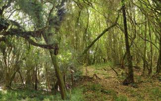
Kaituna Track begins approximately 15 km from Collingwood. Follow the main road from Collingwood to Bainham inland to where Carters Road begins, on a tight corner. The car park is at the end of the road. The track starts from the car park at the end of Carters Road and continues right through to Westhaven Inlet on the West Coast (8–9 hours). Most people, however, walk only to the site of the old Kaituna gold workings (20 min) or on to Kaituna Forks, a 2-hour return trip. The Kaituna Goldfield was first worked in 1859 and continued until the late 1800s, although little gold was ever recovered. The present track follows the original packhorse track to the Kaituna goldfield. From the car park, cross Little Granity Creek using the footbridge and follow the farm track for 400 metres to the start of the walk. A short track takes you past the remains of gold- sluicing operations, water races, tailing piles and a small cave. The side track then cuts back onto the main track. Beyond the Kaituna Forks, the track changes to a ‘route’ and is suitable only for experienced and fit trampers. At the forks there is a river crossing which is impassable in flood. From here it is a further 5–6 hours over a marked route to Knuckle Hill. Beautiful native forest and gold-mining relics are the main attractions of the Kaituna Valley. Magnificent specimens of northern rātā, pukatea and rimu tower over a sub-canopy of nīkau palms, heketara, wineberry, kāmahi, and māhoe. The rich forest and mild climate allow a wide range of birds to flourish: kererū (the New Zealand pigeon), tūī, fantail, tomtit, bush robin, rifleman, silvereye and bellbird.
read more- Location: Carter Road, Collingwood
-

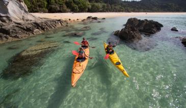
Abel Tasman National Park
New Zealand’s smallest National Park at just 225sq km. Both the inland and coastal tracks are famous for their outstanding beauty, and it’s very easy to take the family on small sections of the coastal track (total is 51km), walking for anything from an hour, half or full day. You can then arrange to pick up a water taxi back to Marahau or Kaiteriteri. The track starts at Marahau, just outside the Park Café. From here you walk along the boardwalks for about 5 minutes, to the start of the actual track. Short walk - the first section of the track is very easy and you can be picnicking on a secluded beach within 20 minutes, admiring the turquoise waters, golden sand and inquisitive birdlife. Other walking options - If you carry on to the first hut on the track, at Anchorage Bay, you’re in for a stunning walk but it’ll be 4 to 5 hours. Water taxis have a scheduled pick up from Anchorage to Marahau, and the last departure is around 3.30pm. Check this before you leave, or book a personalised pick up service. Water taxi cruise / walk – all water taxi companies also offer tours where you can be dropped off at a scenic section of the park and walk for a few hours before you are picked up again. See individual companies for more details.
read more -

Kaihoka Lakes
At Pakawau, turn left off the main road and head over Pakawau Saddle, turning right on to Kaihoka Road just before Whanganui Inlet. Follow this road for 6 kilometres to Kaihoka Lakes Scenic Reserve. Coastal hills form a dramatic backdrop to these beautiful lakes. A 10-minute walking track begins beside one lake and heads gently down to the other. There is space to picnic at the car park and further along the road next to the lake. The reserve is distinguished by its massed nīkau palms, which give the walk a tropical feel. Here and there, dense glades of young mataī, kahikatea, cedar and tānekaha indicate that the forest is recovering after past disturbance. Large, carnivorous Powelliphanta snails live in the reserve and a variety of water fowl can be seen on the lakes. Shags, paradise ducks, Canada geese and grey ducks all find shelter there among the raupō (bullrushes) and reeds.
read more- Location: 342 Limestone Road, Pakawau Saddle, 7073
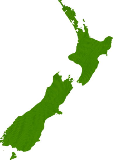
North Island
South Island
- Central Otago
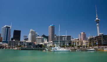
- Auckland
- Bay of Plenty
- Christchurch
- Dunedin
- Coromandel
- Gisborne
- Fiordland
- Hawkes Bay
- Marlborough Sounds
- Manawatu
- Nelson & Golden Bay
- Northland
- North Canterbury
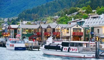
- Queenstown
- Rotorua
- South Canterbury
- Taranaki
- Southland
- Taupo
- Wanaka
- Waikato
- Wellington
- West Coast
- Whangarei
- Bay of Islands
- Tauranga
- Gisborne
- Hamilton
- Napier
- Kapiti
- Palmerston North
- Whanganui
- New Plymouth
- Arrowtown
- Te Anau
- Akaroa
- Ashburton
- Hanmer
- Kaikoura
- Methven
- Mt Cook
- Oamaru
- Tekapo
- Timaru
- Abel Tasman
- Motueka
- Nelson Lakes
- Blenheim
- Picton
- Catlins
- Gore
- Stewart Island
- Central Plateau
- Invercargill
- Cromwell
- Greymouth
- Hokitika
- Westport
- Glenorchy
Our favourite destinations…