Walks & Parks
-

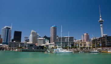
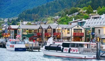
Frankton Arm Walk - Queenstown
Follow Park Street, alongside Queenstown Gardens, down to the lake and Peninsula Street. The Walk begins at the end of this road. A very pleasant walk alongside the lake with views across the Frankton Arm to Kelvin Heights. You come out at Frankton Marina and can continue through to the main beach at Frankton.
read more- Location: Queenstown - end of Park Street, Queenstown
-

Napier - Anderson Park
This 2.6 hectare park has plenty of room for picnics and there are ducks for the children to feed. The playground has lots to keep the children amused with a see-saw, swings, rockers, roundabout and much more. The Hawkes Bay Model Engineering Society runs miniature train rides from Anderson Park Railway Station from 11am on a Sunday along with a sausage sizzle (weather permitting) An easy stroll around the park takes about 30 minutes and there are toilets in the park.
read more- Location: Taradale Road, Greenmeadows Napier
-


Hawkes Bay - Eskdale Park
Eskdale Park is on Shaw Road and is signposted from the highway. The seven hectare park, with trees shading the playground and picnic areas, is popular with holidaymakers who want to cool off in the knee deep river on a hot day. There is plenty of room for the children to run around and the park has two rest rooms.
read more- Location: Shaw Road, off Napier Taupo Road, State Highway 5
-

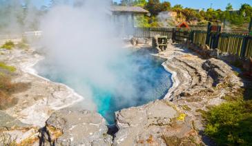
Rotorua - Kuirau Park
This informal park of about 30 hectares is only about five minutes walk to the city centre and has playing fields, a refreshment kiosk, a fountain, a miniature steam railway and children’s play area. You can see boiling mud pools and hot steaming crater lakes in the park and the large garden area has an ornamental lake and geothermally heated foot pools where you can soak your tired feet! A walk throughout the park will take about 40 minutes.
read more- Location: Ranolf Street, Rotorua
-

Dunedin Botanic Gardens - Dunedin
Established in 1863, these are New Zealand’s oldest botanic gardens, located at the corner of Great King Street and Opoho Road. Extensive grounds for exploring, right in the heart of the city. Kids will love the aviaries and duck feeding, and there’s a café and playground on-site. Toilets in both Upper and Lower Garden – those in the Upper Garden have baby changing tables. If you really want to keep the kids occupied, there are a variety of Botanic Gardens Education Kits you can download from www.cityofdunedin.com/city or purchase from the information centre at the gardens. Activity kits take around one hour each. The botanic garden tracks and paths are suitable for buggies.
read more- Location: Dunedin - Opoho Road / Great King Street
-

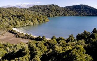
Arawata Track - Queenstown
Stunning views of lake, and cliffs. Beautiful flora and fauna and small streams. Perfect on a nice day. Gentle ups and downs. Path descends down to road at end, so follow this and loop back along road, or return along track.
read more- Location: Queenstown - access from end of lane at 45 Arawata Terrace, Sunshine Bay
-

Queenstown Hill
Set off from top of Belfast Terrace and climb steadily through the forest. You’ll go through an iron gateway that marks the start of the Queenstown Millennium Time Walk. This takes you through the varied history of Queenstown via a series of Story Panels as you climb. Amazing views over the basin from the top of the Hill.
read more- Location: Queenstown - Set off from top of Belfast Terrace and climb steadily through the forest.
-

Mavora Lakes Park
Beautiful lakes, open tussock, grasslands, and beech forest make this a very popular destination in the summer. Many activities are available here including fishing, hiking, biking, or just relaxing and enjoying the scenery. There are options to hike longer distances along the Mavora - Greenstone Walkway, to the Kiwi Burn hut or just a short loop around South Mavora Lake.
read more- Location: 3532 Mavora Lakes Rd, Mavora 9672
-

Te Kopua Beach - Raglan
This is the safest beach in Raglan for swimming. It is accessible from either the road or from the footbridge at the lower end of Bow Street. The beach is black-sand but is popular with families. There is a children’s playground.
read more- Location: Over footbridge by holiday park, Raglan
-

Bathing Beach - Stewart Island
From the general store, continue uphill to your left on the Horseshoe Bay Road and branch right when you reach Kamahi Road (after about 5 minutes). The signposted track descends on the left to a popular bathing beach.
read more- Location: Stewart Island, Horseshoe Bay Road
-

Queens Park - Invercargill
80 hectares (200 acres) of gardens and parkland, minutes from the city centre and next to the main tourist information centre and Southland museum. Queens Park also has an impressive bird aviary, animal enclosures, children’s play areas, extensive sporting facilities, 18 hole golf course, observatory and cafes. Also prominent on the ground is the Southland Museum and Art Gallery. There is a 4 km fitness trail for the energetic, otherwise there are numerous paths and tracks throughout the park.
read more- Location: Invercargill - Queens Park, Gala Street
-

Otago Rail Trail - Highlights
A flat easy walk/bike that you can jump into a section of we recommend the Auripo to Lauder (10.5 km) section. Start at the old Auripo Road Station site – and you can easily walk or cycle through one of the Trail’s special highlights, the Poolburn Gorge. The Trail here is flat or gently downhill – the Poolburn Viaduct, two tunnels, a secluded gorge where you can have a picnic lunch – or you can go for a swim at the longest bridge on the Trail (Manuherikia Bridge) near Lauder. Another option is to start at Lauder, cycle up through the Poolburn Gorge to the Viaduct and return to Lauder.
read more- Location: Lauder, 27km from Alexandra via State Highway 85
-

Hawkes Bay - White Pines Bush
29km north of Napier on SH2, native bush walk with educational panels, native birds and forest. The reserve has huge kahikatea, dwarfing the tawa and pukatea that provide most of the remaining tree cover. Nikau palms are also an attraction. Hanging vines, shrubs and ferns proliferate under the tree canopy, providing habitat for native birds including tui, kereru (native pigeons), fantails, bellbirds, silver-eyes, grey warblers and ruru (morepork). Boardwalks make it easy with buggies and there are two walks to choose from – 30 minutes or 1 hour. Toilets and picnic area.
read more- Location: SH2, 29km north of Napier
-

Hastings - Waimarama Beach
Waimarama Beach is a popular weekend and picnic venue. Its long stretches of sandy beach which are ideal for walking, searching for pipi and swimming are patrolled daily through the summer months. Rock pools are located at the southern end of the beach and Waimarama Domain has a large grassy area with shade, picnic tables and swings. A general store nearby offers snacks like fish and chips and ice cream.
read more- Location: 35 km from Hastings
-

Matapouri Beach - Tutukaka Coast
Ten minutes north of Tutukaka, this magnificent crescent shaped bay with beautiful white sand is a great place for families for surfing, kayaking or just walking along the beach.
read more- Location: Matapouri Road, Tutukaka Coast
-
Taupo - Lake Rotopounamu
The Walking Places guide will take you along this easy track through stunning native forest which is home to abundant native bird life. The walk along a well formed track of about 5 kilometres, with a few hills, will take about two and a half hours. Lunch can be provided, along with pick up from your motel or hotel. See the website for further details.
read more- Location: Lake Rotoponamu
-

Conical Hill
This is a popular track in the Hanmer Forest Park. 1 hr return, the 550m summit offers views of the Hanmer Basin.
read more- Location: Conical Hill Walkway, Hanmer Springs 7334
-

Island Bay
Island bay is surrounded by small bays with calm, clear waters. Between the beach and the Parade is Shorland Park. Popular with local children, the park has a long slide, swings, pirate ship, junior area and basketball half-court. There are also picnic tables, changing sheds and toilets
read more- Location: Opposite Island Bay Beach
-

Taitua Arboretum
If you're looking for a tranquil picnic spot, or an opportunity to escape the bustle of the city, then Taitua Arboretum offers a relaxing retreat. The arboretum has a collection of mature trees covering 20 hectares of open pasture, lakes and woodland gardens which are linked by a network of meandering walking paths. With great views and wonderful bird life, the arboretum is ideal for a family outing or Sunday stroll. Admission is FREE.
read more- Location: From Hamilton follow SH23 west (towards Raglan) and turn left into Howden Road, then left again into Taitua Road.
-

Knuckle Hill Track
Head west from Pakawau over the Pakawau Saddle and down to Whanganui Inlet. Dry Road leads around the inlet, crossing several tidal streams before climbing to a car park at a saddle with a great view of the inlet mouth. Knuckle Hill Track is signposted from the car park. This aptly named hill provides the only elevated viewpoint over Whanganui Inlet, a huge estuary declared a marine reserve and wildlife management reserve in 1994. From the car park, an old logging road climbs gently through regenerating forest to a clearing, where there is plenty of space to relax and picnic. This 5.6-kilometre section of road takes about one hour to walk or a little less to mountain bike. At the clearing, the marked route up Knuckle Hill begins — a short climb of 20 minutes. From the top, right on the boundary of Kahurangi National Park, are excellent views of the top of the South Island, particularly Farewell Spit and Whanganui Inlet.
read more- Location: Knuckle Hill, Kahurangi National Park 7073
-

Pupu Hydro Walkway
Pupu Hydro Walkway (Loop 1 hr 50 min) begins 9 km from Takaka at the end of Pupu Valley Road. Follow the road towards Te Waikoropupū Springs, turning off to the right just before the bridge crossing Waikoropupū River. The Pupu Hydro Walkway retraces an old gold-mining water race, which has been reused for power generation. Botanically the walkway is very interesting, bird life is plentiful, and the history is fascinating. Although the climb to the water race line is a little steep, the first section, across Waikoropupū River to the power station, is an easy grade suitable for all ages. Beyond the power station the track crosses Campbell Creek and zigzags upwards to reach the race after about 30 minutes’ climb. From here the track levels out and follows the race ‘upstream’ for a short distance to a lookout point above the power station. From here on you are strongly advised to carry small children in a backpack and watch other children carefully; a fall from the race and the water itself are potentially dangerous. The water race, which follows the steep contours of the hillside and is part canal and part aqueduct, was an engineering masterpiece for its time. If you look carefully in the water you might see large kōura (freshwater crayfish). Follow the race for 30 minutes or so to the weir (the water intake), which marks the end of the walkway and is a beautiful picnic spot. The weir channels water from the creek into the race; a large shutter was raised or lowered to vary the amount of water taken from the stream. The Hydro Society 4WD vehicle access track from the weir makes the walkway a loop walk (50 min) back to the car park.
read more- Location: Pupu Valley Rd, Tasman Takaka
-

Labyrinth Rocks Walkway
Just two kilometres out of Takaka, on the way to Pohara, are three big oak trees. Turn left here, follow the signs to Labyrinth Rocks Walkway and you will find one of Golden Bay's most amazing places. Nature has produced a maze-like network of canyons through a limestone outcrop " an excellent example of the geological term 'Karst' limestone for which this area is known. It has been developed (and is still in the process of being developed) as an enchanting family attraction. Young or old, you will love exploring all the nooks and crannies - keep younger kids close to you as you can get lost in the maze, older kids will enjoy going off and trying to find their way back. A magical thing to do - is see if you can find little toys and figurines hidden in the rocks - it's the locals kids secret toy swop. So if your child brings their own figure/toy (check out the Salvation Army shop in town), your child can find one they love they can take it and leave theirs in its place! They will be begging to go back the next day.
read more- Location: 7183, 45 Scott Rd, Takaka 7183
-

Rabbit Island Recreation Reserve - Nelson
A popular beach and picnic spot, 15 minutes drive west of Nelson. The island is reachable by a bridge that crosses the estuary behind the island. Most of the island is pine plantations, with a public picnic area in the middle of the front beach. Toilets, changing rooms and outside showers are at the beach. Also picnic tables and coin operated BBQs. The gates are closed at sunset and overnight stays are not allowed so be ready to leave before it gets dark. There is a large sign near the entrance which lets you know what time the gates will be closing that day (in the middle of summer it’s around 9pm).
read more -

Paynes Ford Scenic Reserve
Paynes Ford Scenic Reserve is located along State Highway 60, 3 km south of Takaka. It takes its name from the original ford across the flood-prone Takaka River on the main road into Takaka. A modern bridge now replaces the ford. With its impressive line of limestone bluffs emerging from a remnant patch of forest, Paynes Ford is one of New Zealand’s best rock-climbing areas. Climbers come from far and wide to enjoy the challenge of the sheer rock faces — these are definitely not for beginners! Non-climbers will enjoy a visit to the reserve to picnic, swim, walk or watch the climbers. There is a large picnic area beside the highway bridge. At the southern end of this area is a toilet, where the Paynes Ford Tramline Track (a 30-minute walk) begins. The track provides access to the climbing areas and some excellent swimming holes in the Takaka River. It follows the line of a railway that operated between the early 1880s and 1905 and was used to take timber from the Takaka valley down to Waitapu wharf.
read more- Location: 1886 Takaka Valley Hwy, Takaka 7183
North Island
South Island
- Central Otago
- Auckland
- Bay of Plenty
- Christchurch
- Dunedin
- Coromandel
- Gisborne
- Fiordland
- Hawkes Bay
- Marlborough Sounds
- Manawatu
- Nelson & Golden Bay
- Northland
- North Canterbury
- Queenstown
- Rotorua
- South Canterbury
- Taranaki
- Southland
- Taupo
- Wanaka
- Waikato
- Wellington
- West Coast
- Whangarei
- Bay of Islands
- Tauranga
- Gisborne
- Hamilton
- Napier
- Kapiti
- Palmerston North
- Whanganui
- New Plymouth
- Arrowtown
- Te Anau
- Akaroa
- Ashburton
- Hanmer
- Kaikoura
- Methven
- Mt Cook
- Oamaru
- Tekapo
- Timaru
- Abel Tasman
- Motueka
- Nelson Lakes
- Blenheim
- Picton
- Catlins
- Gore
- Stewart Island
- Central Plateau
- Invercargill
- Cromwell
- Greymouth
- Hokitika
- Westport
- Glenorchy
Our favourite destinations…