Walks & Parks
-

Napier - Centennial Gardens
The Quarry Gardens were developed in the 1970s and the Napier Prison inmates were given the work of extracting the stone. Some prisoners individually carved many stones with personal designs and patterns. Entrance to the Old Napier Prison is 200m further up Coote Road, opposite the park. The gardens are a good picnic spot or take just a few minutes to walk around. The star attraction here is a large waterfall, very tidy and pretty, reminiscent of a Japanese garden.
read more- Location: Coote Road, Napier (200m from Napier Prison - now closed to inmates, open for tours)
-

Bathing Beach - Stewart Island
From the general store, continue uphill to your left on the Horseshoe Bay Road and branch right when you reach Kamahi Road (after about 5 minutes). The signposted track descends on the left to a popular bathing beach.
read more- Location: Stewart Island, Horseshoe Bay Road
-

Molesworth Station tramping tracks
There are five tramping tracks ( 10mins - 2hrs) accessible from the Acheron Road; from short tracks from the cob buildings at Molesworth and Acheron to longer tracks with panorama views.
read more- Location: Acheron Road, Molesworth Station
-

Ruakuri Walkway - Waitomo
The 45 minute return journey is over a well-constructed track which passes through picturesque rain forest and limestone landscale with excellent views of the Ruakuri Natural Tunnel (a remnant cave). There are picnic tables and toilets at the start of the walk.
read more- Location: 3 Kilometres from Waitomo Museum, off Tumutumu Road
-

Wentworth Valley Falls
Wentworth Valley Falls is an easy 3km walk that will take you around 2 hrs 30 mins (return) to complete.This track, from the Wentworth campsite to Wentworth Falls, follows an easy grade alongside the Wentworth River, with two bridged crossings, before climbing to a good view of the falls. The falls are in two drops of about 20 metres each. From here, a steeper tramping track leads to a basin at the top of the falls. This walk can be followed by a 3km walk up the Wentworth River through old Kauri forest.
read more- Location: Turn off SH25, 7 km south of Whangamata on the Coromandel Peninsula, into Wentworth Valley Road.
-

Piha Beach
All the beaches on this stretch of the West Coast are black iron sand beaches. The safest place for swimming for children is at low tide in the Blue Pool off The Gap. The main beaches are not recommended for young children to swim in as they are primarily surf beaches. Nearby is the Piha Domain which contains toilets and a camping ground and is a great place for picnics.
read more -

Auckland Domain
The Auckland Domain is probably best known for the annual CocaCola Christmas in the Park extravaganza. This 75 hectare park is Auckland’s oldest and has been developed around an extinct volcano. There are duck ponds, sportsfields and the Auckland War Memorial Museum is located right in the middle!
read more- Location: 20 Park Road, 21 Domain Drive, George Street, Titoki Street and 72 – 80 Stanley Street, Parnell
-

Estuary Walkway - Invercargill
Walking/cycling loop track through the estuary margins (access off Stead Street). Well-formed gravel track (approx 5.5km) with boardwalks, providing views of the estuary. Interpretive panels, seating and shelters are along the track.
read more- Location: Invercargill, Stead Street
-

Hawkes Bay - Ocean Beach
One of the best beaches in Hawkes Bay with 10 kilometres of golden sand, Ocean beach is extremely popular with holiday makers in the summer months. The waters are safe for swimming, although a current will carry you down the beach a little. Lifeguards patrol during the busiest months. Ocean Beach is relatively undeveloped with no shops nearby, so bring your own food!
read more- Location: South East of Hastings, nth of Waimarama
-

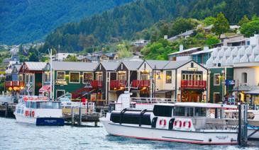
Frankton Arm Walk - Queenstown
Follow Park Street, alongside Queenstown Gardens, down to the lake and Peninsula Street. The Walk begins at the end of this road. A very pleasant walk alongside the lake with views across the Frankton Arm to Kelvin Heights. You come out at Frankton Marina and can continue through to the main beach at Frankton.
read more- Location: Queenstown - end of Park Street, Queenstown
-

Cooper's Beach - Doubtless Bay
One of the safest beaches in Northland, this two and a half kilometre unspoiled beach has safe swimming and shade. There is a children’s playground nearby and a shopping centre and restaurant. There is a local product market at the shopping centre every Saturday.
read more- Location: Doubtless Bay
-

Peel Forest Park Scenic Reserve
Peel Forest is located in the foothills of the Southern Alps; turn off SH 72, about 12 km north of Geraldine. Once at the forest, a wide variety of short and long tracks extend into the park but for littlies choose the beginning of the Big Tree Walk, which is suitable for prams and wheelchairs.Explore the largest reserve in the Geraldine area on a variety of tracks. Base yourself at the campsite and take your time.
read more- Location: Peel Forest is accessed from Rangitata Gorge Road and from Blandswood Road.
-

Napier - Waipatiki Beach
This stretch of golden sand is in the picturesque settlement of Waipatiki, 45 minutes north of Napier and a short walk from the car park. The sandy area of the beach is flanked by cliffs and the beach is reported to be a good place to find paua shells, although the current here is strong so swimming is not recommended. There is a beach picnic area, toilets and a camping ground nearby.
read more- Location: 11km from SH2, 45 minutes drive from Napier
-

Lake Matheson - Fox Glacier
At Fox Glacier township, turn onto the Cook Flat road and drive for 5km, where you’ll see the turn off for Lake Matheson. The walk around Lake Matheson is best done at sunrise, and if the weather is clear and still, you will be rewarded with incredible reflections of Mount Cook. Any time of day, however, it’s a pleasant lakeside/ancient forest walk, with backdrop views of the Southern Alps, flanked by Aoraki/Mt Cook. Restaurant, toilets and carpark onsite.
read more -

Devil's Punchbowl Waterfall - Arthur's Pass
Just outside of the Arthurs Pass village (on the West Coast side) are a number of reasonably short and easy walks, including the half hour track to the Devils Punchbowl Falls. A large bridge first takes you over the rocky river before the path winds up through the bush. The track is easy to follow and in good repair. Rocky in parts, some care needs to be taken as you clamber over tree roots, but much of the track has been set with board walk and steps. The bush scenery is lush and stunning, and as you arrive at the falls, a viewing platform gives you a good view of the Devil’s Punchbowl.
read more -

Hawkes Bay - Lake Waikaremoana
1 hour drive off SH2, or on the way if heading to Rotorua on SH38. The road is unsealed for several stretches, and quite narrow, so care must be taken, and drive in lower gear than for sealed road. Campsite, shop and picnic area down by lake. Great for swimming, or you can hire row boats or kayaks. 400m further round there’s a DOC information centre and lots of short (30 mins) to multi-day bush walks.
read more- Location: 2 hours drive north of Napier, turn off SH2 onto SH38
-

Hokitika Gorge Walk
Just a short 15 min walk takes you to excellent views of the blue-green waters of the Hokitika River as it makes its way through the rock sided Hokitika Gorge - this short, easy walk is a great option for kids. From the car park, follow the walking track for a few minutes through dense podocarp/hardwood forest before emerging onto a viewing platform. From here you can look down to the stunning Hokitika Gorge and out to the lush farmland of Kowhitirangi. This part of the track is accessible for wheelchairs. From the viewing platform, continue for another 6 minutes along the curving boardwalks and you will reach a swing bridge. From here there are excellent views of the blue-green waters of the Hokitika River as it makes its way through the rock sided Hokitika Gorge. For good views further up the gorge, cross the swing bridge and when you come to the end of it turn left (straight ahead leads to private farmland). The track continues for another 200 m through the bush to another viewing platform with looking out to the gorge upstream of the bridge.
read more- Location: Whitcombe Valley Rd, Hokitika Gorge, Kokatahi 7881
-

Hastings - Te Mata Peak Lookout
Good, sealed road to the top of this impressive hill, that winds up on one side, and drops straight down in a sheer bluff on the other. Impressive 360 views from the top, of the whole Hawkes Bay region, and on a clear day you can see as far as Mount Ruapehu. Scattered, tiny, below are some of the fabulous wineries of the Hawkes Bay district, along with the Te Mata cheesery.
read more -
Hawkes Bay - Te Angiangi Marine Reserve -
The Te Angiangi Marine Reserve was established in 1997 and covers an area of about 446 hectares between Blackhead and Aramoana beaches. The reserve, which protects this part of the coast, offers opportunities for swimming, walking, shore diving and boating. Between Blackhead and Paoanui Point at low tide birds like kingfishers, oyster catchers and godwits can be seen. Explore the rock pools to find fish, crabs and kina (but return any rocks to their original position) or snorkel in the sheltered waters of Stingray or Shelly Bays and discover reef animals like paua, opal shells and rock lobsters.
read more- Location: Central Hawkes Bay,30 km east of Waipukurau and Waipawa
-

Mangawhai Estuary - South of Waipu
The dunes which border this estuary are constantly changing. The estuary is safe for swimming but you need to be careful of the outgoing tide near the mouth of the harbour. Kids will enjoy collecting cockles and pipi further up the harbour.
read more- Location: 36 km north of Wellsford, South of Waipu
-

Drift Bay Picnic Area - Queenstown
Kingston/Milford Sound Road, only a few kilometres from Frankton just after the Lakeside Estate turn off. Either picnic near your car or take a 10 minute walk down to a lovely secluded beach spot with table. Ideal getaway for relaxing, fishing or bathing. There’s also a very easy 1 hour return walk from this spot following the beach round to Drift Bay.
read more- Location: Queenstown - Kingston Highway (State Hgwy 6), Right hand side, just after the Lakeland Estate development.
-

Moeraki Boulders - Oamaru
An unique beach experience as the beach is filled with massive round boulders - some which are split open to expose the layers beneath. A fun natural playground to explore and have a wander. It's a short walk down to the beach with parking at the cafe.
read more- Location: Moeraki Village, Oamaru, New Zealand
-

Cave Stream Scenic Reserve
This really is a hidden gem, and an adventure activity with older children that is FREE! You can opt for either the above ground 30 minutes return for each track, or add the cave walk through water if the conditions are right. The reserve is well signposted off SH 73 between the Broken River road bridge and Craigieburn Forest Park entrance. Two short, but steep tracks lead from the reserve car park to the cave entrances. You will need to help or carry little ones in a child carrier pack. The easier track to the upstream entrance goes through a karst (limestone) landscape of sculptured rock formations. The other track leads to the edge of a terrace and then drops steeply down to the junction of Cave Stream and Broken River. The limestone formations nearby were the settings for the filming of The Chronicles of Narnia. The 600-metre cave walk itself is not suitable for little children, but is a great adventure for older families that are well prepared, with torches, warm gear and plenty of dry clothes to change into. A separate brochure describes the cave adventure. Note: Do not attempt to enter the cave if the stream is high, with the water discoloured or foaming.
read more- Location: Castle Hill 7580, SH73 between the Broken River road bridge and Craigieburn Forest Park entrance.
-

Mt. John Summit Circuit Track - Tekapo
The start of this track is located next to the Tekapo Springs complex. The track rises steadily up through exotic forest and then open tussock hill slopes. Mt John is fantastic viewing platform with a 360-degree panorama of the surrounding mountains, lakes and Mackenzie Basin flats. The Mt John Observatory and cafe are at the top.
It is possible to drive to the top of Mt John and walk the Summit Circuit Track (30 - 45 min).
read more- Location: Mount John Observatory
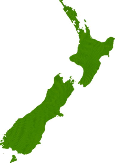
North Island
South Island
- Central Otago
- Auckland
- Bay of Plenty
- Christchurch
- Dunedin
- Coromandel
- Gisborne
- Fiordland
- Hawkes Bay
- Marlborough Sounds
- Manawatu
- Nelson & Golden Bay
- Northland
- North Canterbury
- Queenstown
- Rotorua
- South Canterbury
- Taranaki
- Southland
- Taupo
- Wanaka
- Waikato
- Wellington
- West Coast
- Whangarei
- Bay of Islands
- Tauranga
- Gisborne
- Hamilton
- Napier
- Kapiti
- Palmerston North
- Whanganui
- New Plymouth
- Arrowtown
- Te Anau
- Akaroa
- Ashburton
- Hanmer
- Kaikoura
- Methven
- Mt Cook
- Oamaru
- Tekapo
- Timaru
- Abel Tasman
- Motueka
- Nelson Lakes
- Blenheim
- Picton
- Catlins
- Gore
- Stewart Island
- Central Plateau
- Invercargill
- Cromwell
- Greymouth
- Hokitika
- Westport
- Glenorchy
Our favourite destinations…